
Trace a Winchester Street Directory
A street-by-street search is strongest when it keeps ownership, parcel geography, and resident evidence separate. First locate the physical parcel. Then identify the assessed owner and any linked deed fields. The deed can establish a transfer trail, while historic lists and newspapers can place people at a street during a specific period. The process does not create a current household list. Renters, minors, protected voters, and many other occupants are not revealed by property data.
Save the street spelling, number, taxkey, parcel ID, deed book and page, date, and source with each finding. These control fields are especially important when several Winchester addresses share a street name, when a parcel has been split or merged, or when an old record uses a former street name. A separate owner mailing address is a contact field, not proof that the owner lives at the parcel.
- Enter the street name, and then a number if known, in the Winchester assessor search. Record the taxkey, location, owner, sale fields, and book or page if shown.
- Open the same block in the GIS Parcel Map, display parcel IDs, addresses, and road names, and confirm the mapped parcel.
- Search MassLandRecords by the verified owner, town, date, property, or book and page. Check both grantor and grantee roles.
- Read the legal description and plan references before assuming an older deed uses the same modern address.
- For a historical household, ask the Local History Room for the relevant resident list or street-arranged material and compare it with dated newspaper or deed evidence.
Search Winchester Streets in Patriot
The Winchester Patriot Properties advanced search is the main modern address entry point. It has optional Parcel, Owner, Street name, and Street num fields. It can also narrow property records by building type, year built, beds, baths, lot size, finished area, land-use code, value, neighborhood, sale price, sale date, book, and page. Its result rows include taxkey, location, owner, built year, type, value, beds, baths, lot and finished area, land-use description, and sale information.
| Search field | Street-directory use | How to read it |
|---|---|---|
| Street name | Browse parcels on a named Winchester street | Add a number only when narrowing a known address |
| Owner | Find the assessed-owner record | Check the result location before accepting a name match |
| Parcel | Carry one tax identifier across records | Cross-check it in the GIS panel |
| Book and page | Provide a possible Registry lead | Verify on the recorded instrument |
The assessor search form below shows the range of available filters.
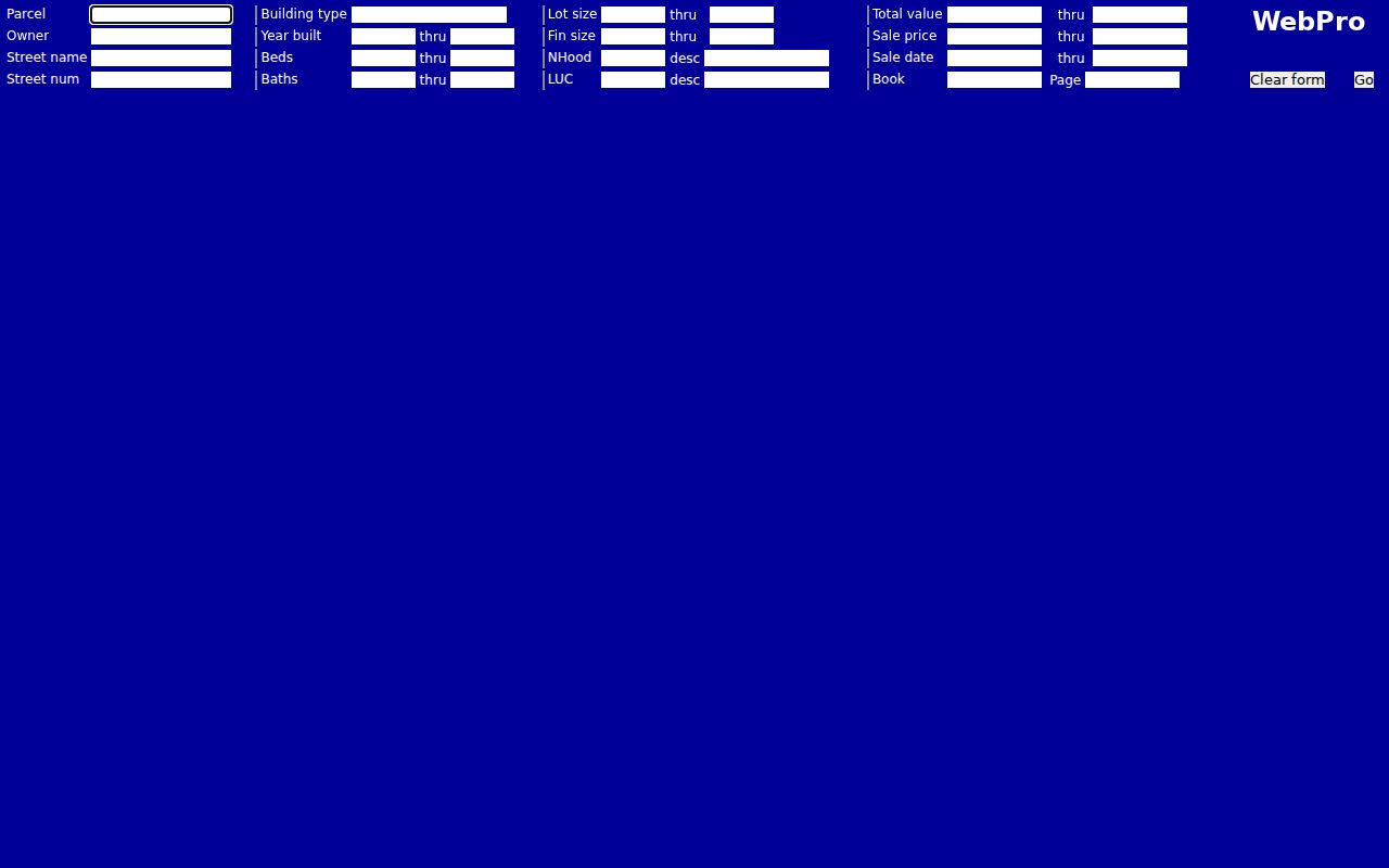
A Patriot result is useful for a current assessment clue. It does not state that the owner lives at the Winchester street address.
Map Winchester Street Parcels
The Town of Winchester GIS makes the street search geographic. Parcel Map, aerial imagery, parcel addresses, parcel IDs, road names, voting precincts, parks, schools, and topography are available layers. Click the target polygon, then use the property panel’s PROP_ID, SITE_ADDR, OWNER1, and mailing fields to compare it with the assessor result. Pan to adjacent polygons only after identifying the target parcel.
The Town’s GIS disclaimer matters. Its displayed update dates and accuracy warning mean map data should be treated as a dated municipal source. It is excellent for seeing which parcel is next to another parcel. It is not a live occupancy map, and a polygon can represent shared land, open space, a public site, a utility area, or a condominium component rather than a separate household.
The Winchester GIS viewer in the image below shows the parcel-map route.
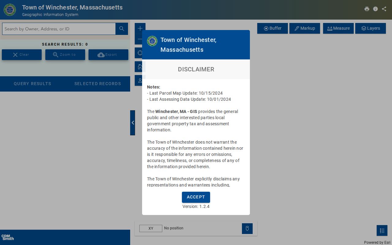
Use the mapped parcel ID as a bridge to Patriot or the Registry, not as a shortcut for naming everyone on a street.
Define Winchester Address Records
Address documents use several keys. Keeping them separate prevents a street directory search from joining unrelated records or mistaking a mailing clue for a residence claim.
- Parcel
- A mapped unit of land identified by a taxkey or parcel ID.
- Situs address
- The physical location of the parcel, shown in GIS as
SITE_ADDRor on a card as Location. - Owner mailing address
- The address where an owner receives mail, often returned by GIS as
OWN_ADDRandOWN_CSZ. - Plat or plan
- A recorded map reference that can connect a legal lot to a street when a deed lacks a modern house number.
- Criss-cross directory
- An address-to-name directory. A distinct Winchester run was not verified, so ask the Local History Room before relying on one.
Preserve the original spelling and number from each source. A present-day normalized address can be useful for an index note, but it should not overwrite a historic deed or directory form.
Winchester Street Directory Sources
Address-keyed records cover different parts of a Winchester street trail. The assessor card starts with an assessed owner and situs. GIS confirms which parcel is being discussed. Registry documents record transfers and legal descriptions. Building and Engineering records can identify work, plans, or utility connections. Historical resident lists may put a person on a street in a particular year. The state voter web form is individual-only, so it cannot be converted into a street-wide lookup.
| Record Set | Keeper | What It Shows | Access |
|---|---|---|---|
| Patriot assessment card | Winchester Assessors | Owner, situs, taxkey, property and sale clues | Free web search |
| GIS parcel map | Town of Winchester | Parcel boundary, ID, mapped address, ownership schema | Free public viewer |
| Recorded or registered land | Middlesex South Registry | Parties, transfers, liens, plans, legal descriptions | Free index and online copies |
| Building and Engineering files | Town departments | Work, plans, roadway layouts, utility or hookup clues | Online or office request |
| Resident lists and directories | WPL and Town Clerk | Historical people by precinct, street, or list arrangement | Reference or clerk route |
A parcel ID or taxkey ties the first two sources together. A verified owner and legal description connect that parcel to land records. Street spelling, house number, precinct, and year help locate historical sources. Do not make the state voter form stand in for a block roster, and do not turn a property owner into a claim about every person at that street address.
Note: When a record is held only at an office, request the document type, address, and date range rather than asking for an open-ended search.
Follow Winchester Street Deeds
For one property, start with the confirmed Patriot owner and then search the Middlesex South land portal as grantee around the likely purchase date. Confirm the Winchester town, legal description, plan, and book or page. The grantor named in that instrument becomes the next earlier grantee search. Repeat the same checks backward. Search a trust or entity name as well as individual trustee names where the assessment record uses both.
The Registry’s modern recorded-land name index begins in 1974, with images generally available from 1986. For earlier seller-side leads, its Grantor Index PDFs cover 1896 through 1973. Registered Land is a different certificate and document-number workflow dating from 1899. A plan reference can be more reliable than a house number when streets changed, lots merged, or a historic deed lacks a current address.
The official MassLandRecords search below shows the separate Recorded Land and Registered Land paths.
MassLandRecords makes document retrieval free online. A certified copy is a separate Registry service, and a recorded instrument should be read before relying on an index line.
Check Winchester Street Aliases
Historic address work in Winchester needs old place names and street aliases. The town incorporated in 1850 from parts of Woburn, Medford, and West Cambridge or Arlington, so earlier records may sit under those parent jurisdictions. Waterfield, South Woburn, and Black Horse Village are also useful historical labels. The 1854 map includes Fruit Street, now Hutchinson, alongside names such as Main, Washington, Forest, Cross, Pleasant, Pond, Bacon, Grove, Church, and High.
Search the former name and the modern name, then compare the lot, plan, abutting owners, and road context. An address change is not a reason to force two records together. It is a prompt to find the deed, map, or directory evidence that shows they refer to the same land. This historical-alias check is particularly useful when a street directory search reaches a pre-incorporation record.
Use Winchester Street History Files
Winchester Building permits began about 1924. A permit can provide an issue date, basic work description, architect, or contractor when one exists, but an older house may have no early permit. Engineering holds roadway layouts, assessor maps, subdivision plans, public-building plans, and utility plans. A water hookup card can supply a building date or original-owner clue. These are source-specific leads, not a replacement for a deed chain.
The Town’s House History route also points to MACRIS and local survey material. The Winchester Historical Commission’s 1979 pre-1917 building survey has 12 volumes covering more than 2,000 structures standing then. It can add construction, style, ownership-history, or architect and builder context. For a full current-address workflow, follow the parcel and deed path first; use the historic files to explain the property’s physical timeline.
Read Winchester Street Lists Carefully
The Local History Room reports Winchester resident lists from 1901 through 2019, and the official lists from 1925 through 1970 are arranged by precinct, street, and alphabetically. From 1971 forward, the described series is a list of residents seventeen and older. The older series had an over-twenty threshold. Those format changes matter when using a missing name as evidence. A historic list can establish that its own editor or custodian recorded someone in a period; it cannot prove every member of a household.
A distinct Winchester reverse or criss-cross directory was not verified. Ask reference staff whether an address-to-occupant volume exists for the year at issue. Otherwise, use the street-arranged resident lists, Blue Book or house-guide material, the Winchester Star indexes, and property records as separate dated sources rather than calling an ordinary alphabetical directory a reverse directory.
Limit Winchester Voter Inferences
Massachusetts’ individual voter-status search requires a first name, last name, full date of birth, ZIP code, and agreement checkbox. It is not a street search. Public voter information has statutory limits, and phone, email, minor, and confidential-voter information is not public. Municipal voter-file access has its own requester and production rules through the Town Clerk. Registration status alone does not prove who occupies a whole home or block.
For a personal, lawful question about an address, use a targeted record and stop where privacy protections begin. A statewide web form, a parcel map, and a tax card cannot be combined into an unverified household profile.
Winchester Street Directory Limits
A Winchester street directory can document an assessed owner, a parcel, a recorded transfer, an address-keyed permit, or a historical directory entry. It cannot identify every renter, household member, visitor, minor, or protected person. Motor-vehicle personal information is restricted by the federal DPPA, and utility customer records are not an ordinary public address source. A nearby map polygon is a parcel, not automatically a neighbor household.
Massachusetts Address Confidentiality Program participants and confidential voters are intentionally shielded. The right response to a missing or protected result is to respect that boundary. If an official record appears inaccurate, ask the office that created it about its correction process, instead of combining partial results from unrelated sources.
Lawful use. Winchester street records can support family history, property research, civic questions, and personal safety. Do not use names, addresses, or records to stalk, harass, intimidate, or harm anyone.